| |
| |
|
The Proposed Technology |
|
|
|
Create a device that is capable of: |
|
|
1. Operating for over a month at a time
2. Temporarily attaching to a drill (drills are often owned by contractors)
3.
User-friendly software that can be used to track:
- drill speed
- area covered
- operating time
|
The Potential Solution
After months of testing several different GPS dataloggers and associated software, one device seemed to have the required capabilities listed above.
The device has enough memory to log a data point every five seconds, 24 hours a day, for more than 23 days.
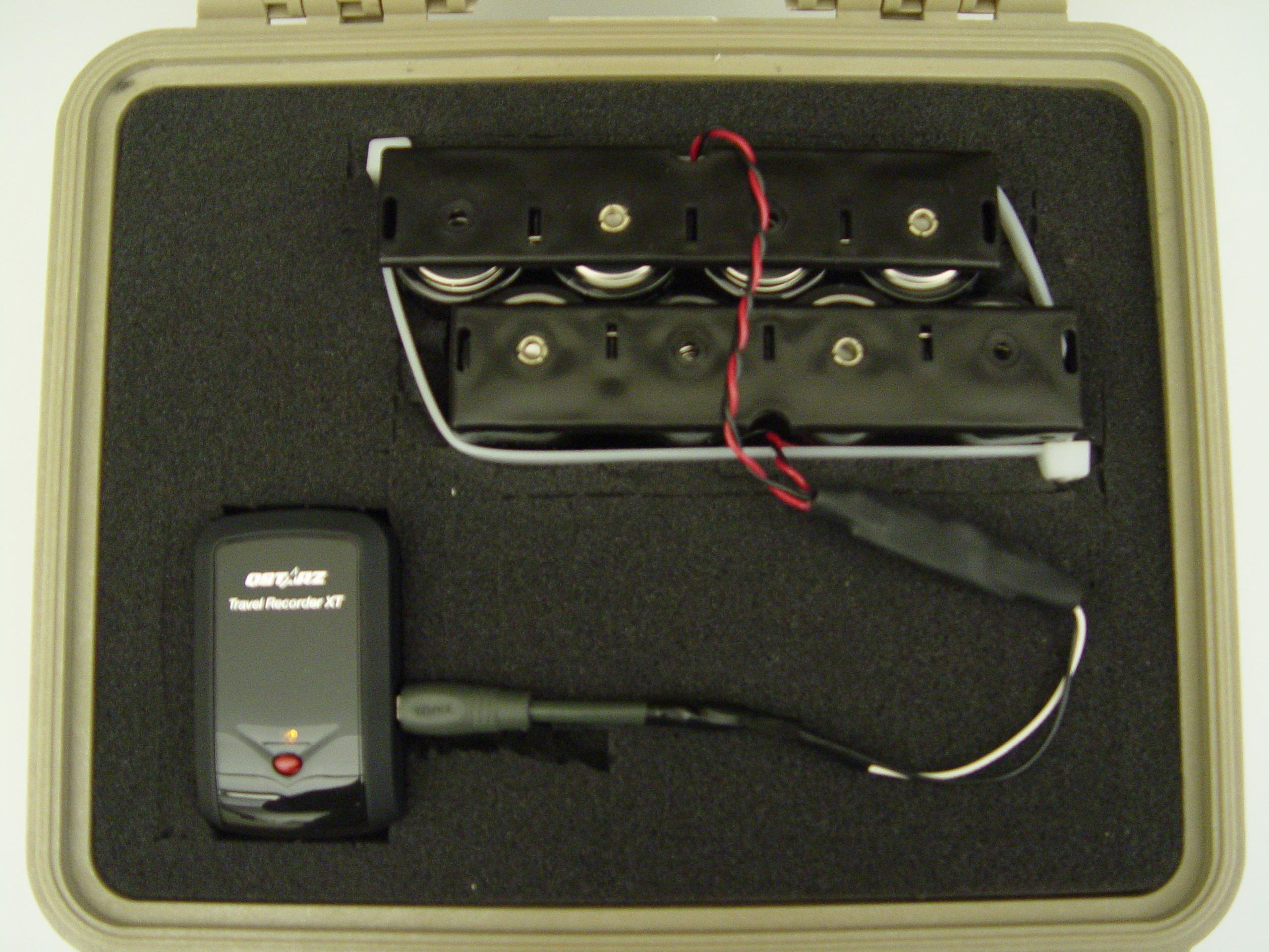
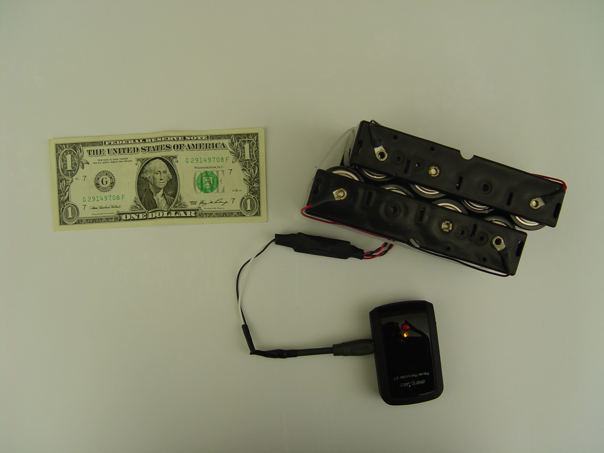
With the aid of a modified battery pack (eight 1.5V D-cell batteries), the device can run for up to 40 days of continuous operation.
The software provides the ability to program the device to Power On and begin logging data at pre-programmed intervals set by the device owner or representative of the owner. This ability to program the device extends the number of days the device will remain operable. For instance, pre-programming 10-12 hour workdays will allow for more data collection before the memory or battery maxes out.
The device is housed inside a waterproof, lockable case that is secured temporarily to the drill by rare Earth magnets.
|
|
 |
| |
 |
| |
 |
|
Examples of included Software.jpg)
This is the pre-programmable schedule area of the software. Here, the device can be told WHEN to Power On and Off. This facet of the software not only improves the longevity of the device (by maximizing battery life and memory space) but also allows owners to monitor whether the drill operator followed the specifications outlined in the contract.
|
| |
 This area of the software is where the owners can pre-program how often the device takes a GPS point. This option is useful if the area to be seeded has a complicated layout, such as archeaological points to avoid. More data points will create a more detailed map of the drill's tracks. However, if the area consists mostly of long, straight stretches, less points would be required to create a map of the tracks.
The software also includes:
Vibration Detector
- this option
ensures the datalogger will stop taking points when the drill is not in motion
Buzzer
- the owner can program the device to sound an alarm if the drill excedes a specified speed
The owner of the device can also program the device to make a decision when the memory is reaching capacity. The idea is to make this device as self-sufficient as possible. |
| |
What data is collected and how can it be put to use? |
Operation Time - how much time was spent moving vs. stopped?
Distance Traveled - was enough seed provided to cover the area?
Maximum Speed - did the drill excede the specified speed? when and where?
Average Speed - did the drill speed allow for an accurate seeding rate?
Altitude Changes - provides the owner with more detail about the seeded area
|
.jpg)
Using GoogleEarth, the GPS points from
the device can be overlayed on a satellite map.
**For optimal data accuracy, the device's case should be attached to the drill to give
an unobstructed view of the sky (on top of the seed boxes, etc.).
|
| |
Cost
The unit shown in the photos costs around $200 and includes the following:
- GPS datalogger and software
- waterproof/lockable case with five rare Earth magnets
- 2 battery cases
- 8 D-cell batteries
- modified mini USB power cable |
| |
| |
While this device is still in the testing phase we are enthusiastic about its potential
and look forward to the improvements it can bring to rangeland restoration. |
| |
| |
| |
Damien Hoffman, Project Leader
USDA Forest Service, Missoula Technology & Development Center,
5785 Highway 10 West, Missoula, MT 59808-9361
phone: 406-829-6751, email: damienhoffman@fs.fed.us
Collaborators
USDA Forest Service, Rocky Mountain Research Station, Boise, ID
Truax Co., Inc., New Hope, MN
Glade Jones, Hindsite Co., La Barge, WY
|

.jpg)